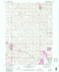
1968 Map of Elkhorn
USGS Topo · Published 1983About this map
The agrarian and institutional landscape of Douglas County is defined by the drainage of Big Papillion Creek and its various branches as they wind toward the Missouri River. In the late 1960s, the historic settlement of Elkhorn remains a distinct rail-oriented hub along the Union Pacific line, while nearby Boys Town stands as a prominent campus-style development to the southeast. The area is dotted with rural landmarks essential to local genealogy, including the St Patricks Seminary, Sunny Side Sch, and School No 67.
Find a feature on this map
22 named features on this map. Tap any name to fly to it.
Don’t see what you’re looking for? This feature index may not catch every label — zoom into the map to look around manually.
Map Details
Editions of this 1968 Elkhorn Map
4 editions found
Other maps of this area

1893 · Fremont
USGS Topo · 1:125,000

1896 · Fremont
USGS Topo · 1:125,000

1955 · Fremont
USGS Topo · 1:250,000

1956 · Gretna
USGS Topo · 1:24,000

1956 · Ralston
USGS Topo · 1:24,000

1956 · Irvington
USGS Topo · 1:24,000

1957 · Fremont
USGS Topo · 1:250,000

1958 · Fremont
USGS Topo · 1:250,000

1968 · Valley
USGS Topo · 1:24,000

1968 · Kennard
USGS Topo · 1:24,000