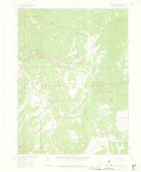
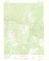
1962 Map of Elkhorn Mountain
USGS Topo · Published 1969About this map
Elkhorn Mountain dominates this high-country landscape within the Routt National Forest, where the complex drainage of the Middle Fork Little Snake River carves through the Colorado backcountry. The map documents a rugged network of land use, from the Elkhorn Mine on the northern slopes to the solitary Dead Mexican Park Grave in the southeast. These markers, along with the Summit Creek Guard Station, reflect the high-altitude isolation and the resource-driven history of the region in the early 1960s.
Find a feature on this map
26 named features on this map. Tap any name to fly to it.
Don’t see what you’re looking for? This feature index may not catch every label — zoom into the map to look around manually.
Map Details
Editions of this 1962 Elkhorn Mountain Map
5 editions found
Other maps of this area

1911 · Hahns Peak
USGS Topo · 1:125,000

1913 · Hahns Peak
USGS Topo · 1:125,000

1932 · Savery
USGS Topo · 1:96,000

1939 · Saratoga
USGS Topo · 1:125,000

1940 · Savery
USGS Topo · 1:125,000

1954 · Rawlins
USGS Topo · 1:250,000

1954 · Craig
USGS Topo · 1:250,000

1957 · Craig
USGS Topo · 1:250,000

1958 · Rawlins
USGS Topo · 1:250,000

1958 · Craig
USGS Topo · 1:250,000