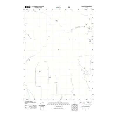
2011 Map of Elkhorn Peak
USGS Topo · Published 2011About this map
Elkhorn Peak and Elkhorn Mountain dominate this high-altitude landscape in Bannock County, where drainage systems like Indian Mill Creek and Elkhorn Creek carve deep through the terrain. The map reveals a network of remote canyons, including Monson Canyon, Limekiln Canyon, and Co-Op Canyon, suggesting a history of local grazing and resource extraction. Evidence of early water management is visible through numerous named water sources such as Bissell Spring, Station Spring, and Secret Spring. Transportation is limited to rugged routes like Power House Rd and E Elkhorn Rd, which provide access to the Summit Campground and high meadows like Old Canyon Meadow. The presence of the Little Malad River in the southwest corner marks the lower elevations of this mountain study.
Find a feature on this map
33 named features on this map. Tap any name to fly to it.
Don’t see what you’re looking for? This feature index may not catch every label — zoom into the map to look around manually.
Map Details
Editions of this 2011 Elkhorn Peak Map
This is the sole edition of this map. No revisions or reprints were ever made.
Other maps of this area

1954 · Pocatello
USGS Topo · 1:250,000

1958 · Pocatello
USGS Topo · 1:250,000

1963 · Daniels
USGS Topo · 1:24,000

1968 · Ireland Springs
USGS Topo · 1:24,000

1968 · Daniels
USGS Topo · 1:24,000

1968 · Malad Summit
USGS Topo · 1:24,000

1968 · Dairy Creek
USGS Topo · 1:24,000

1968 · Malad City West
USGS Topo · 1:24,000

1968 · Downey West
USGS Topo · 1:24,000

1968 · Malad City East
USGS Topo · 1:24,000