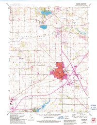
1960 Map of Elkhorn
USGS Topo · Published 1994About this map
Elkhorn serves as the focal point of this 1960s agricultural and residential landscape, centered in Walworth County at the intersection of various local roads and the Chicago and North Western rail line. The town's grid is well-defined by streets such as Page St and Rockwell St, while educational and civic life is anchored by St. Patricks School and the High School. To the north and west, the terrain transitions into a patchwork of rural homesteads and early-century landmarks like Abells Corners and the community of Tibbets, which features its own Tibbets School and Townhall.
Find a feature on this map
58 named features on this map. Tap any name to fly to it.
Don’t see what you’re looking for? This feature index may not catch every label — zoom into the map to look around manually.
Map Details
Editions of this 1960 Elkhorn Map
3 editions found
Other maps of this area

1892 · Whitewater
USGS Topo · 1:62,500

1892 · Eagle
USGS Topo · 1:62,500

1893 · Delavan
USGS Topo · 1:62,500

1893 · Whitewater
USGS Topo · 1:62,500

1893 · Geneva
USGS Topo · 1:62,500

1894 · Eagle
USGS Topo · 1:62,500

1897 · Eagle
USGS Topo · 1:62,500

1903 · Whitewater
USGS Topo · 1:62,500

1904 · Lake Geneva
USGS Topo · 1:62,500

1906 · Eagle
USGS Topo · 1:62,500