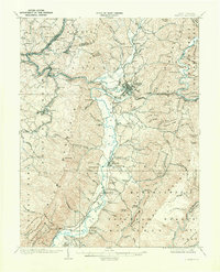
1909 Map of Elkins
USGS Topo · Published 1971About this map
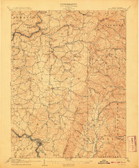
The Tygart River valley serves as the central artery for this early 20th-century survey, anchoring the major settlements of Elkins and Beverly during a period of significant industrial expansion. The landscape is defined by the convergence of heavy rail and historic transit routes, most notably the Staunton and Parkersburg Pike and the Western Maryland RR, which facilitated the movement of coal and timber from the surrounding highlands. This era showcases a dense network of rural education and small company towns, from Coalton and Junior to numerous isolated institutions like Stoneseal School and Goff School. The topography is dominated by the steep rises of Rich Mountain and Laurel Ridge, where landmarks such as Arnold Hill and Burnt Bridge provide specific points of reference for local historians and genealogists tracing early Appalachian development.
Find a feature on this map
126 named features on this map. Tap any name to fly to it.
Don’t see what you’re looking for? This feature index may not catch every label — zoom into the map to look around manually.
Map Details
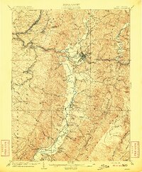
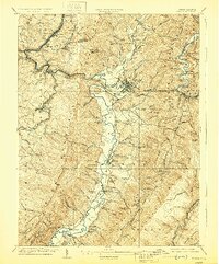
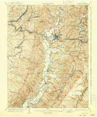
Editions of this 1909 Elkins Map
4 editions found
Other maps of this area

1886 · St. George
USGS Topo · 1:125,000

1889 · Beverly
USGS Topo · 1:125,000

1891 · St. George
USGS Topo · 1:125,000

1892 · Beverly
USGS Topo · 1:125,000

1893 · Buckhannon
USGS Topo · 1:125,000

1896 · Buckhannon
USGS Topo · 1:125,000

1897 · Buckhannon
USGS Topo · 1:125,000

1904 · Philippi
USGS Topo · 1:62,500
1907 · Belington
USGS Topo · 1:62,500

1908 · Parsons
USGS Topo · 1:62,500