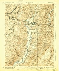
1909 Map of Elkins
USGS Topo · Published 1929About this map
The Staunton and Parkersburg Turnpike and the Seneca Trail intersect in this mountain landscape, marking a critical junction for commerce and migration through Randolph County. The terrain is defined by the deep valley of the Tygart River, flanked by the massive elevations of Rich Mountain and Cheat Mountain. In Elkins, the Western Maryland Ry and Coal and Coke Ry converge, illustrating the town's role as a regional hub for the timber and coal industries. Small rural nodes like Beverly and Junior appear alongside an extensive network of family-named schools and churches, such as Stonewall School and Valley Bend Church. The presence of the Burnt Bridge and various tramroads reveals a landscape heavily involved in resource extraction, where rail lines follow the winding river banks to navigate the gaps between the high ridges.
Find a feature on this map
107 named features on this map. Tap any name to fly to it.
Don’t see what you’re looking for? This feature index may not catch every label — zoom into the map to look around manually.
Map Details
Editions of this 1909 Elkins Map
4 editions found

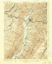
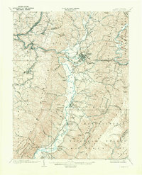
Other maps of this area

1886 · St. George
USGS Topo · 1:125,000

1889 · Beverly
USGS Topo · 1:125,000

1891 · St. George
USGS Topo · 1:125,000

1892 · Beverly
USGS Topo · 1:125,000

1893 · Buckhannon
USGS Topo · 1:125,000

1896 · Buckhannon
USGS Topo · 1:125,000

1897 · Buckhannon
USGS Topo · 1:125,000

1904 · Philippi
USGS Topo · 1:62,500

1907 · Belington
USGS Topo · 1:62,500

1908 · Parsons
USGS Topo · 1:62,500