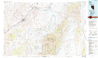
1986 Map of Elko
USGS Topo · Published 1986About this map
The Humboldt River corridor dominates this 1980s landscape, serving as the primary artery for both water and transport through Elko County. The city of Elko sits at a geographic crossroads where the Southern Pacific and Western Pacific railroads parallel Interstate 80. This mid-1980s era shows the region's complex land use, from the tribal lands of the South Fork Indian Reservation and Elko Colony Ind Res to the high-elevation terrain of the Humboldt National Forest. In the rugged heights of the Ruby Mountains, landmarks like Soldier Pk and Lamoille Canyon overlook the Lamoille Valley. Small settlements such as Lamoille and Halleck anchor the ranching and mining operations that define the rural economy, including the Polar Star Mine and Echo Mine tucked into the eastern ranges.
Find a feature on this map
77 named features on this map. Tap any name to fly to it.
Don’t see what you’re looking for? This feature index may not catch every label — zoom into the map to look around manually.
Map Details
Editions of this 1986 Elko Map
This is the sole edition of this map. No revisions or reprints were ever made.
Other maps of this area

1934 · Jiggs
USGS Topo · 1:125,000

1935 · Halleck
USGS Topo · 1:125,000

1937 · Jiggs
USGS Topo · 1:125,000

1952 · Dixie Flats
USGS Topo · 1:62,500

1952 · Pine Valley
USGS Topo · 1:62,500

1952 · Carlin
USGS Topo · 1:62,500

1953 · Spruce Mountain
USGS Topo · 1:62,500

1955 · McDermitt
USGS Topo · 1:250,000

1955 · Wells
USGS Topo · 1:250,000

1955 · Winnemucca
USGS Topo · 1:250,000