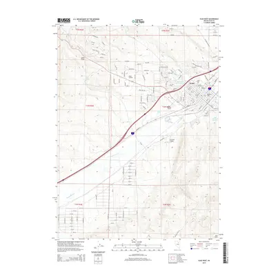
2015 Map of Elko West
USGS Topo · Published 2015About this map
The Humboldt River carves through the heart of this Nevada landscape, anchoring the city of Elko as it expands toward the Adobe Range and Elko Hills. This 2015 survey documents the modern layout of the regional hub, showing the significant footprint of the Elko Regional Airport and the campus of Great Basin Coll. Geothermal features like Elko Hot Springs and the Hot Hole indicate the unique hydrology of the river valley, while the residential grids of Missouri Flat and new developments like Adobe Heights show the city's outward growth. For local historians, the map preserves the exact boundaries of the Elko City Cemetery and Masonic Cemetery, situated just north of the river's bend. Infrastructure such as the Fifth Street Wash Reservoir and Airport Ponds manage the drainage from the surrounding canyons including Dobe Canyon.
Find a feature on this map
165 named features on this map. Tap any name to fly to it.
Don’t see what you’re looking for? This feature index may not catch every label — zoom into the map to look around manually.
Map Details
Editions of this 2015 Elko West Map
This is the sole edition of this map. No revisions or reprints were ever made.
Other maps of this area

1952 · Dixie Flats
USGS Topo · 1:62,500

1955 · Elko
USGS Topo · 1:250,000

1957 · Elko West
USGS Topo · 1:24,000

1957 · Elko East
USGS Topo · 1:24,000

1958 · Elko
USGS Topo · 1:250,000

1958 · Hunter
USGS Topo · 1:24,000

1958 · Doby Summit
USGS Topo · 1:24,000

1962 · Elko
USGS Topo · 1:250,000

1962 · Kittridge Springs
USGS Topo · 1:24,000

1962 · Osino
USGS Topo · 1:24,000