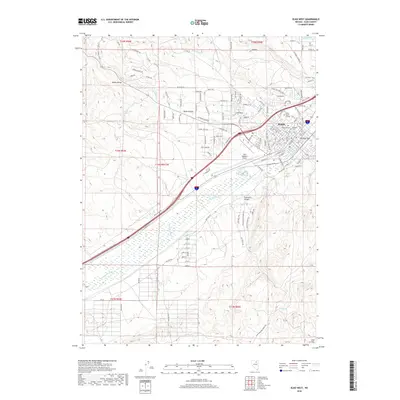
2018 Map of Elko West
USGS Topo · Published 2018About this map
The Elko city limits and its western expansion dominate this late-2010s survey, illustrating the modern footprint of one of Nevada's vital interior hubs. The Humboldt River carves through the center of the sheet, flanked by significant infrastructure including the Elko Regional Airport and its associated Airport Ponds. Cultural landmarks such as Great Basin College and the adjacent Elko City Cem and Masonic Cem are clearly delineated, providing essential reference points for local history.
Find a feature on this map
114 named features on this map. Tap any name to fly to it.
Don’t see what you’re looking for? This feature index may not catch every label — zoom into the map to look around manually.
Map Details
Editions of this 2018 Elko West Map
This is the sole edition of this map. No revisions or reprints were ever made.
Other maps of this area

1952 · Dixie Flats
USGS Topo · 1:62,500

1955 · Elko
USGS Topo · 1:250,000

1957 · Elko West
USGS Topo · 1:24,000

1957 · Elko East
USGS Topo · 1:24,000

1958 · Elko
USGS Topo · 1:250,000

1958 · Hunter
USGS Topo · 1:24,000

1958 · Doby Summit
USGS Topo · 1:24,000

1962 · Elko
USGS Topo · 1:250,000

1962 · Kittridge Springs
USGS Topo · 1:24,000

1962 · Osino
USGS Topo · 1:24,000