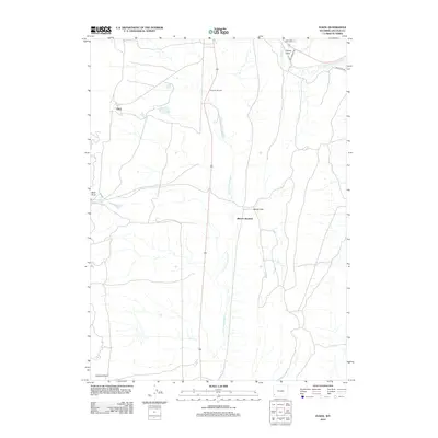
2012 Map of Elkol
USGS Topo · Published 2012About this map
Elkol sits at the western edge of this Lincoln County landscape, a region defined by the drainage networks of the N Fork Little Muddy Cr and the Hams Fork to the north. The area's industrial and transport history is reflected in several key transit points, including Glencoe Junction and Blazon Junction. These intersections and the nearby Blazon Gap suggest a geography shaped by access routes through the high desert terrain. Water management is critical in this arid environment, evidenced by the presence of Skull Point Reservoir tucked near Skull Point. To the southeast, the elevation rises toward Crockers Point, while local residential life is represented by named corridors like Oakley St and Willowood Rd near the northern boundary. This map captures the intersection of natural topography and the infrastructure supporting local connectivity in southwest Wyoming.
Find a feature on this map
13 named features on this map. Tap any name to fly to it.
Don’t see what you’re looking for? This feature index may not catch every label — zoom into the map to look around manually.
Map Details
Editions of this 2012 Elkol Map
This is the sole edition of this map. No revisions or reprints were ever made.
Other maps of this area

1954 · Ogden
USGS Topo · 1:250,000

1954 · Kemmerer
USGS Topo · 1:62,500

1958 · Ogden
USGS Topo · 1:250,000

1960 · Ogden
USGS Topo · 1:250,000

1962 · Cumberland Gap
USGS Topo · 1:24,000

1962 · Elkol SW
USGS Topo · 1:24,000

1962 · Elkol
USGS Topo · 1:24,000

1962 · Warfield Creek
USGS Topo · 1:24,000

1969 · Willow Springs
USGS Topo · 1:24,000
1969 · Mulkay Spring
USGS Topo · 1:24,000