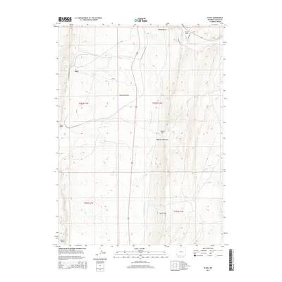
2015 Map of Elkol
USGS Topo · Published 2015About this map
Cumberland Flats dominates the central landscape of this western Wyoming terrain, situated just south of the established community of Kemmerer. The area is defined by its prominent ridgelines and drainage basins, notably Oyster Ridge and the watercourse of Hams Fork in the northeast corner. Traces of regional development are evident in the proximity of small settlements and junctions, including Elkol and Blazon Junction, which serve as markers for the area's transition from high-desert flats to more complex topography.
Find a feature on this map
20 named features on this map. Tap any name to fly to it.
Don’t see what you’re looking for? This feature index may not catch every label — zoom into the map to look around manually.
Map Details
Editions of this 2015 Elkol Map
This is the sole edition of this map. No revisions or reprints were ever made.
Other maps of this area

1954 · Ogden
USGS Topo · 1:250,000

1954 · Kemmerer
USGS Topo · 1:62,500

1958 · Ogden
USGS Topo · 1:250,000

1960 · Ogden
USGS Topo · 1:250,000

1962 · Cumberland Gap
USGS Topo · 1:24,000

1962 · Elkol SW
USGS Topo · 1:24,000

1962 · Elkol
USGS Topo · 1:24,000

1962 · Warfield Creek
USGS Topo · 1:24,000

1969 · Willow Springs
USGS Topo · 1:24,000
1969 · Mulkay Spring
USGS Topo · 1:24,000