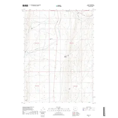
2017 Map of Elkol
USGS Topo · Published 2017About this map
Cumberland Flats defines the central expanse of this 2017 study, where the high desert landscape of Lincoln County meets the industrial and transport infrastructure of southwest Wyoming. The topographic record highlights the settlement of Elkol in the northwest and Blazon Junction situated near Blazon Gap. These points, along with the southern periphery of Kemmerer, show a region shaped by resource extraction and land management. The drainage of N Fork Little Muddy Cr and the waters of Hams Fork provide a stark contrast to the prominent ridgelines like Oyster Ridge and Skull Point. Local transportation routes, including Co RD 304 and the road to Skull Point Reservoir, trace the contours of the terrain, illustrating the modern connectivity of this historically significant mining and ranching corridor.
Find a feature on this map
22 named features on this map. Tap any name to fly to it.
Don’t see what you’re looking for? This feature index may not catch every label — zoom into the map to look around manually.
Map Details
Editions of this 2017 Elkol Map
This is the sole edition of this map. No revisions or reprints were ever made.
Other maps of this area

1954 · Ogden
USGS Topo · 1:250,000

1954 · Kemmerer
USGS Topo · 1:62,500

1958 · Ogden
USGS Topo · 1:250,000

1960 · Ogden
USGS Topo · 1:250,000

1962 · Cumberland Gap
USGS Topo · 1:24,000

1962 · Elkol SW
USGS Topo · 1:24,000

1962 · Elkol
USGS Topo · 1:24,000

1962 · Warfield Creek
USGS Topo · 1:24,000

1969 · Willow Springs
USGS Topo · 1:24,000
1969 · Mulkay Spring
USGS Topo · 1:24,000