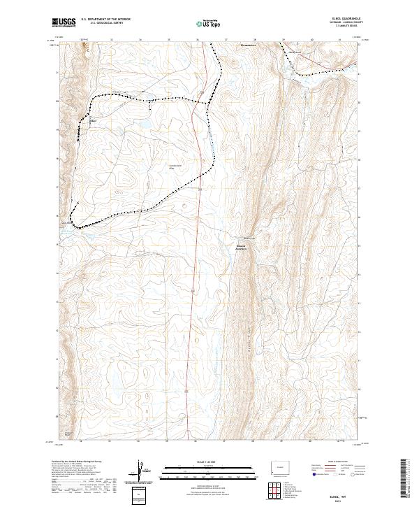
2021 Map of Elkol
USGS Topo · Published 2021About this map
Oyster Ridge dominates the eastern half of this terrain, where steep-sided hills give way to the more level expanses of Cumberland Flats. This high-elevation landscape in Lincoln County is punctuated by small settlements and water sources like the N Fork Little Muddy Cr and the Skull Point Reservoir. The area is marked by its mining and transportation history, evidenced by the proximity of Elkol and Blazon Junction. To the north, the terrain transitions toward Kemmerer, with drainage features such as Oakley Draw feeding into the Hams Fork. The map provides a detailed view of the section lines and township boundaries that defined land ownership in this part of Wyoming, including points like Skull Point and Crockers Point that serve as prominent navigational landmarks across the ridges.
Find a feature on this map
20 named features on this map. Tap any name to fly to it.
Don’t see what you’re looking for? This feature index may not catch every label — zoom into the map to look around manually.
Map Details
Editions of this 2021 Elkol Map
This is the sole edition of this map. No revisions or reprints were ever made.
Other maps of this area

1954 · Ogden
USGS Topo · 1:250,000

1954 · Kemmerer
USGS Topo · 1:62,500

1958 · Ogden
USGS Topo · 1:250,000

1960 · Ogden
USGS Topo · 1:250,000

1962 · Cumberland Gap
USGS Topo · 1:24,000

1962 · Elkol SW
USGS Topo · 1:24,000

1962 · Elkol
USGS Topo · 1:24,000

1962 · Warfield Creek
USGS Topo · 1:24,000

1969 · Willow Springs
USGS Topo · 1:24,000
1969 · Mulkay Spring
USGS Topo · 1:24,000