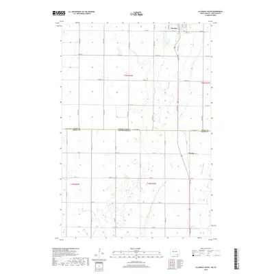
2018 Map of Ellendale South
USGS Topo · Published 2018About this map
Ellendale sits at the northern edge of this Great Plains survey, marking a primary hub where the rural grid of Dickey County, North Dakota, meets the border of Brown County, South Dakota. The landscape is defined by the subtle drainages of Sewer Br and Dry Br, which wind through a section-line road network designed for large-scale agriculture. Further south, the small settlement of Winship appears along the highway corridor, serving as a localized point of interest within the South Dakota portion of the quadrangle. The map illustrates the strict rectilinear organization of the region, from the major thoroughfare of 89th Ave SE to the numerous county roads like Co Rd 10 and Co Rd 3 that facilitate movement across this interstate boundary.
Find a feature on this map
36 named features on this map. Tap any name to fly to it.
Don’t see what you’re looking for? This feature index may not catch every label — zoom into the map to look around manually.
Map Details
Editions of this 2018 Ellendale South Map
This is the sole edition of this map. No revisions or reprints were ever made.
Other maps of this area

1894 · Monango
USGS Topo · 1:62,500

1894 · Ellendale
USGS Topo · 1:62,500

1894 · Savo
USGS Topo · 1:62,500

1894 · Fullerton
USGS Topo · 1:62,500

1895 · Lamoure
USGS Topo · 1:125,000

1896 · Columbia
USGS Topo · 1:125,000

1896 · Edgeley
USGS Topo · 1:125,000

1899 · Ellendale
USGS Topo · 1:125,000

1918 · La Moure
USGS Topo · 1:125,000

1925 · Edgeley
USGS Topo · 1:125,000