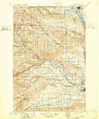
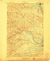
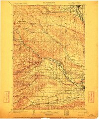
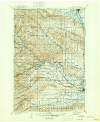
1901 Map of Ellensburg
USGS Topo · Published 1932About this map
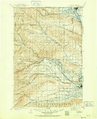
The Northern Pacific RR follows the Yakima River as it cuts through the high desert and ridges of central Washington, anchoring the development of early Ellensburg and Yakima. Surveyed in 1899, this map reveals a landscape defined by sharp elevation changes, from the heights of Cleman Mountain to the agricultural potential of Selah Valley. The presence of the Old Durr Road and the scattered settlements of Wenas, Nile, and Tampico suggest a period of transition where early freighting routes and remote ranching hubs were being integrated into the rail-linked economy. To the south, the Yakima Indian Reservation boundary borders the Ahtanum Creek drainage, while the northwestern corner is dominated by the dense timberlands of the Rainier National Forest. These early topographic details provide a clear view of the complex irrigation and transport networks forming around Cowiche Creek and Wide Hollow at the turn of the century.
Find a feature on this map
46 named features on this map. Tap any name to fly to it.
Don’t see what you’re looking for? This feature index may not catch every label — zoom into the map to look around manually.
Map Details
Editions of this 1901 Ellensburg Map
6 editions found
Other maps of this area

1897 · Mount Stuart
USGS Topo · 1:125,000

1899 · Ellensburg
USGS Topo · 1:125,000

1901 · Ellensburg
USGS Topo · 1:125,000

1901 · Snoqualmie Pass
USGS Topo · 1:125,000

1902 · Mount Aix
USGS Topo · 1:125,000

1902 · Mount Stuart
USGS Topo · 1:125,000

1903 · Snoqualmie
USGS Topo · 1:125,000

1904 · Mt Aix
USGS Topo · 1:125,000

1904 · Mount Adams
USGS Topo · 1:125,000

1907 · Mount Adams
USGS Topo · 1:125,000