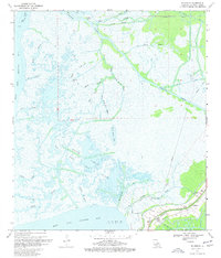
1970 Map of Ellerslie
USGS Topo · Published 1977About this map
Industrial extraction and tidal marshlands define the coastal landscape of St. Mary Parish as recorded in 1970. The southern edge of the map is dominated by the vast waters of West Cote Blanche Bay and East Cote Blanche Bay, separated by the distinctive inlet known as The Jaws. Inland, the area is characterized by a complex network of bayous including Cop Cop Bayou, Black Crook Bayou, and Wild Buck Bayou, which weave through the wetlands alongside engineered waterways like the Intracoastal Waterway and the Williams Storage Canal. The local economy of the era is clearly visible through the extensive Garden City Gas and Oil Field and Sale Bayou Oil and Gas Field, showing the infrastructure of the energy industry. Small settlements like Ellerslie and South Bend anchor the terrestrial portion of the map near a local Pumping Station.
Find a feature on this map
40 named features on this map. Tap any name to fly to it.
Don’t see what you’re looking for? This feature index may not catch every label — zoom into the map to look around manually.
Map Details
Editions of this 1970 Ellerslie Map
4 editions found
Other maps of this area

1935 · Belle Isle
USGS Topo · 1:31,680

1937 · Bayou Sale
USGS Topo · 1:62,500

1937 · Jeanerette
USGS Topo · 1:62,500

1941 · Belle Isle
USGS Topo · 1:62,500

1945 · New Orleans
USGS Topo · 1:250,000

1948 · Foster
USGS Topo · 1:62,500
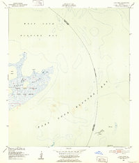
1951 · Lake Point
USGS Topo · 1:24,000

1954 · Jeanerette
USGS Topo · 1:62,500

1954 · Belle Isle
USGS Topo · 1:62,500

1957 · Bayou Sale
USGS Topo · 1:62,500