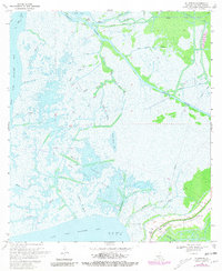
1970 Map of Ellerslie
USGS Topo · Published 1981About this map
Bayou Sale and the surrounding marshlands of St. Mary Parish define this coastal landscape at the start of the 1970s. The map illustrates an intricate network of natural waterways and industrial alterations, where the Intracoastal Waterway cuts through established bayous such as Portage Bayou and Wild Buck Bayou. The presence of the Oil and Gas Field Bayou Carlin and numerous Drill Holes highlights the region's reliance on mineral extraction, while the Pumping Station near Ellerslie speaks to the ongoing efforts to manage water levels in this low-lying delta environment.
Find a feature on this map
37 named features on this map. Tap any name to fly to it.
Don’t see what you’re looking for? This feature index may not catch every label — zoom into the map to look around manually.
Map Details
Editions of this 1970 Ellerslie Map
4 editions found
Other maps of this area

1935 · Belle Isle
USGS Topo · 1:31,680

1937 · Bayou Sale
USGS Topo · 1:62,500

1937 · Jeanerette
USGS Topo · 1:62,500

1941 · Belle Isle
USGS Topo · 1:62,500

1945 · New Orleans
USGS Topo · 1:250,000

1948 · Foster
USGS Topo · 1:62,500
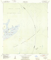
1951 · Lake Point
USGS Topo · 1:24,000

1954 · Jeanerette
USGS Topo · 1:62,500

1954 · Belle Isle
USGS Topo · 1:62,500

1957 · Bayou Sale
USGS Topo · 1:62,500