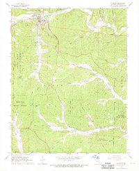
1968 Map of Ellington
USGS Topo · Published 1969About this map
Ellington serves as the primary hub in this late 1960s Ozark landscape, where the town's grid meets the winding courses of Logan Creek and Ellington Creek. The map documents a deeply memorialized landscape, featuring an exceptional concentration of family and community burial grounds including Imboden Cem, Pratt Cem, Chitwood Cem, and Bethlehem Cem. These sites, often situated near watercourses or on elevated ridges like the one hosting Ellington Memorial Cem, offer significant data for genealogical research in Reynolds County.
Find a feature on this map
49 named features on this map. Tap any name to fly to it.
Don’t see what you’re looking for? This feature index may not catch every label — zoom into the map to look around manually.
Map Details
Editions of this 1968 Ellington Map
3 editions found
Other maps of this area

1928 · Cardareva
USGS Topo · 1:62,500

1943 · Ellington
USGS Topo · 1:62,500

1943 · Lesterville
USGS Topo · 1:62,500

1944 · Corridon
USGS Topo · 1:62,500

1945 · Ellington
USGS Topo · 1:62,500

1946 · Lesterville
USGS Topo · 1:62,500

1947 · Corridon
USGS Topo · 1:62,500

1949 · Rolla
USGS Topo · 1:250,000

1949 · Cardareva
USGS Topo · 1:62,500

1953 · Rolla
USGS Topo · 1:250,000