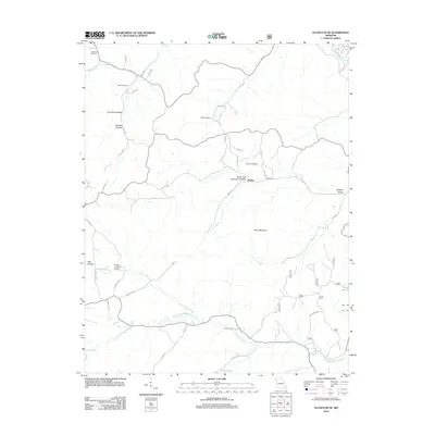
2012 Map of Ellington SE
USGS Topo · Published 2012About this map
Hadley and Duncan serve as the primary focal points in this 2012 survey of Reynolds County, situated near the headwaters of the Black River. The landscape is defined by its complex drainage network, where Big Brushy Creek and its many tributaries, such as Devils Run and South Fork Big Brushy Creek, carve through the terrain. Notable elevation features like Bear Mountain overlook deep hollows and valleys, including Hurricane Hollow and South Fork Greenwood Valley. For genealogists and family historians, several burial grounds are preserved across the area, including Potter Cemetery, Webb Cemetery, Atwood Cemetery, and Copeland Cemetery. The presence of the Flying 'J' Ranch Airport and an extensive network of county roads like Co RD 583 and Co RD 576 illustrate the modern transportation structure of these rural communities.
Find a feature on this map
48 named features on this map. Tap any name to fly to it.
Don’t see what you’re looking for? This feature index may not catch every label — zoom into the map to look around manually.
Map Details
Editions of this 2012 Ellington SE Map
This is the sole edition of this map. No revisions or reprints were ever made.
Other maps of this area

1932 · Piedmont
USGS Topo · 1:62,500

1934 · Williamsville
USGS Topo · 1:48,000

1935 · Piedmont
USGS Topo · 1:62,500

1940 · Williamsville
USGS Topo · 1:62,500

1943 · Ellington
USGS Topo · 1:62,500

1944 · Grandin
USGS Topo · 1:62,500

1945 · Ellington
USGS Topo · 1:62,500

1946 · Grandin
USGS Topo · 1:62,500

1949 · Rolla
USGS Topo · 1:250,000

1953 · Rolla
USGS Topo · 1:250,000