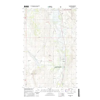
2017 Map of Ellisforde
USGS Topo · Published 2017About this map
The Okanogan River corridor anchors this portion of north-central Washington, where the valley floor transitions into the high peaks of the Okanogan National Forest. The small settlement of Ellisforde serves as a central hub, connected by Hwy 7 and the Ellisforde Bridge Rd. This area is defined by its complex glacial and volcanic geography, featuring a string of distinct water bodies such as Whitestone Lake, Poison Lake, and the high-elevation Crater Lakes. The landscape is notable for its numerous named peaks, including Whisky Mtn and Pickens Mtn, which overlook the agricultural operations at Whitestone Flats. To the north, the community of Cordell sits near the winding banks of the river, while a network of ranch and access roads like Loomis-Oroville Rd and Swanson Mill Rd weave through the rugged coulees and timberlands that characterize this borderlands region.
Find a feature on this map
59 named features on this map. Tap any name to fly to it.
Don’t see what you’re looking for? This feature index may not catch every label — zoom into the map to look around manually.
Map Details
Editions of this 2017 Ellisforde Map
This is the sole edition of this map. No revisions or reprints were ever made.
Other maps of this area

1902 · Osoyoos
USGS Topo · 1:125,000

1904 · Osoyoos
USGS Topo · 1:125,000

1906 · Chopaka
USGS Topo · 1:125,000

1954 · Okanogan
USGS Topo · 1:250,000

1956 · Loomis
USGS Topo · 1:62,500

1957 · Conconully
USGS Topo · 1:62,500

1957 · Tonasket
USGS Topo · 1:62,500

1957 · Oroville
USGS Topo · 1:62,500

1958 · Okanogan
USGS Topo · 1:250,000

1975 · Oroville NW
USGS Topo · 1:24,000