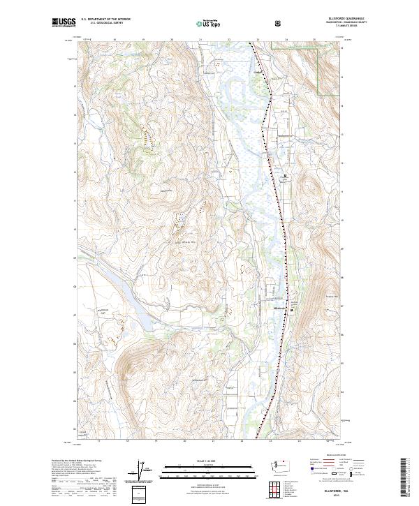
2023 Map of Ellisforde
USGS Topo · Published 2023About this map
The Okanogan River corridor anchors this portion of Okanogan County, where the valley floor transitions into the high peaks of the Okanogan National Forest. The settlement at Ellisforde is the primary hub of this landscape, situated near the river and the Ellisforde Mission Cem. To the north, the small community of Cordell sits near Borse Lake and Lake Andrews, reflecting the reliance on water in this arid stretch of eastern Washington. The topography is defined by significant elevations such as Whisky Mtn and Whitestone Mtn, while Whitestone Lake and the Whitestone Coulee provide distinct geographic breaks in the terrain. For genealogists and local historians, the map identifies specific points of interest including the Mountain View Memorial Cem and various named roads like Attwood Ranch Rd and Swanson Mill Rd that hint at the area's agricultural and ranching heritage.
Find a feature on this map
64 named features on this map. Tap any name to fly to it.
Don’t see what you’re looking for? This feature index may not catch every label — zoom into the map to look around manually.
Map Details
Editions of this 2023 Ellisforde Map
This is the sole edition of this map. No revisions or reprints were ever made.
Other maps of this area

1902 · Osoyoos
USGS Topo · 1:125,000

1904 · Osoyoos
USGS Topo · 1:125,000

1906 · Chopaka
USGS Topo · 1:125,000

1954 · Okanogan
USGS Topo · 1:250,000

1956 · Loomis
USGS Topo · 1:62,500

1957 · Conconully
USGS Topo · 1:62,500

1957 · Tonasket
USGS Topo · 1:62,500

1957 · Oroville
USGS Topo · 1:62,500

1958 · Okanogan
USGS Topo · 1:250,000

1975 · Oroville NW
USGS Topo · 1:24,000