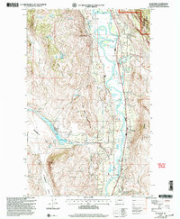
2001 Map of Ellisforde
USGS Topo · Published 2004About this map
The Okanogan River carves a fertile valley through this portion of north-central Washington, creating a landscape of contrast between irrigated bottomlands and the steep slopes of Whitestone Mountain and Whisky Mountain. At the heart of the valley lies the community of Ellisforde, where local infrastructure including a Grange Hall and Cem suggest a settled agricultural history. The river's meandering course is punctuated by oxbows like Horseshoe Lake, while the western uplands feature the prominent Whitestone Flats and the Whitestone Coulee geological formation.
Find a feature on this map
28 named features on this map. Tap any name to fly to it.
Don’t see what you’re looking for? This feature index may not catch every label — zoom into the map to look around manually.
Map Details
Editions of this 2001 Ellisforde Map
This is the sole edition of this map. No revisions or reprints were ever made.
Other maps of this area

1902 · Osoyoos
USGS Topo · 1:125,000

1904 · Osoyoos
USGS Topo · 1:125,000

1906 · Chopaka
USGS Topo · 1:125,000

1954 · Okanogan
USGS Topo · 1:250,000

1956 · Loomis
USGS Topo · 1:62,500

1957 · Conconully
USGS Topo · 1:62,500

1957 · Tonasket
USGS Topo · 1:62,500

1957 · Oroville
USGS Topo · 1:62,500

1958 · Okanogan
USGS Topo · 1:250,000

1975 · Oroville NW
USGS Topo · 1:24,000