
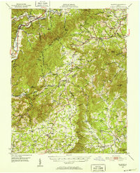
1950 Map of Elliston
USGS Topo · Published 1952About this map
The South Fork Roanoke River and North Fork Roanoke River converge in the northwest corner of this terrain, where the Norfolk and Western Roanoke and Virginian railroads parallel the Lee Highway. This mid-century survey documents the transition from the valley floor settlements like Elliston and Shawsville up into the high ridges of the Blue Ridge. The landscape is dotted with numerous small congregations such as Bend Union Ch and Kittingers Chapel, reflecting a dispersed rural community structure. High atop Bent Mtn, the map shows the emerging technological infrastructure of the era with the Radio Tower (WDBJ) and the State Police Radio Mast. The Appalachian Trail winds through these heights, passing landmarks like Adney Gap and the Airpoint landing strip, while the Blue Ridge Parkway skirts the southern ridges through Franklin County.
Find a feature on this map
98 named features on this map. Tap any name to fly to it.
Don’t see what you’re looking for? This feature index may not catch every label — zoom into the map to look around manually.
Map Details
Editions of this 1950 Elliston Map
4 editions found
Other maps of this area

1890 · Roanoke
USGS Topo · 1:125,000

1890 · Christiansburg
USGS Topo · 1:125,000

1891 · Roanoke
USGS Topo · 1:125,000

1923 · Waiteville
USGS Topo · 1:62,500

1925 · Rocky Mount
USGS Topo · 1:48,000

1927 · Rocky Mount
USGS Topo · 1:62,500

1929 · Roanoke
USGS Topo · 1:48,000

1929 · Salem
USGS Topo · 1:48,000

1931 · Waiteville
USGS Topo · 1:48,000

1932 · Salem
USGS Topo · 1:62,500