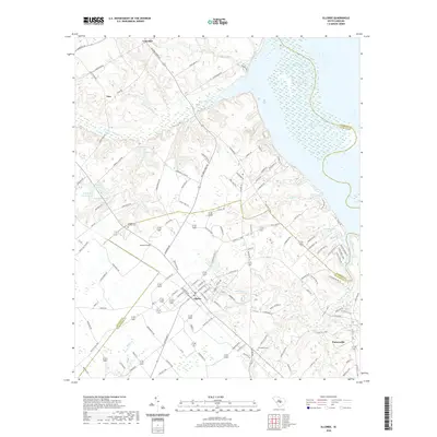
2020 Map of Elloree
USGS Topo · Published 2020About this map
The town of Elloree serves as a central hub in this section of Orangeburg County, where the transition from inland agricultural tracts to the marshy shores of Lake Marion defines the landscape. Residential streets give way to a network of rural roads such as Felderville Rd and Bookhardt Rd, connecting the main settlement to smaller points like Tina and Lone Star. The geography is deeply influenced by the lake's reach, with several large ponds including R E Rast Pond and Camp Daniels Pond dotting the northern and eastern portions of the map.
Find a feature on this map
109 named features on this map. Tap any name to fly to it.
Don’t see what you’re looking for? This feature index may not catch every label — zoom into the map to look around manually.
Map Details
Editions of this 2020 Elloree Map
This is the sole edition of this map. No revisions or reprints were ever made.
Other maps of this area

1920 · Eutawville
USGS Topo · 1:48,000

1920 · Bowman
USGS Topo · 1:48,000

1921 · Bowman
USGS Topo · 1:62,500

1921 · Eutawville
USGS Topo · 1:62,500

1943 · Bowman
USGS Topo · 1:62,500

1943 · Orangeburg
USGS Topo · 1:125,000

1943 · Eutawville
USGS Topo · 1:62,500

1946 · Elloree
USGS Topo · 1:62,500

1954 · Augusta
USGS Topo · 1:250,000

1957 · Augusta
USGS Topo · 1:250,000