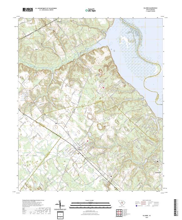
2024 Map of Elloree
USGS Topo · Published 2024About this map
Elloree serves as the primary hub of this landscape, situated at the intersection of several regional routes and the dividing line between Calhoun and Orangeburg counties. The town's grid is dense with named streets, contrasting with the more rural settlements of Lone Star, Tina, and Partersville to the north and east. This coastal plain environment is defined by its complex hydrology, where Halfway Swamp Creek and Big Poplar Creek feed into the expansive waters of Lake Marion and the Santee River. Genealogists will find significant local history preserved at several sites, including the Bookhardt and Santee cemeteries, alongside established houses of worship such as Union Church and Jerusalem Church. The map also reveals numerous private impoundments like D H Rast House Pond and R E Rast Pond, reflecting long-standing local land use and agricultural patterns near the lake shore.
Find a feature on this map
116 named features on this map. Tap any name to fly to it.
Don’t see what you’re looking for? This feature index may not catch every label — zoom into the map to look around manually.
Map Details
Editions of this 2024 Elloree Map
This is the sole edition of this map. No revisions or reprints were ever made.
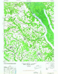
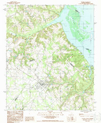
Historical Maps of Elloree Through Time
3 maps found