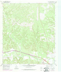
1970 Map of Elm Slough
USGS Topo · Published 1987About this map
The Llano River winds through the southern portion of this landscape, serving as a primary drainage for a network of seasonal watercourses including Bear Creek and Nixon Creek. This 1970s survey, updated with 1980s data, reveals the transition from traditional ranching to mid-century infrastructure. Rural life is anchored by the Bolt Ranch and the Bear Creek Cem, while newer developments such as the County Airport and a Drive-in Theater appear near the river's edge.
Find a feature on this map
22 named features on this map. Tap any name to fly to it.
Don’t see what you’re looking for? This feature index may not catch every label — zoom into the map to look around manually.
Map Details
Editions of this 1970 Elm Slough Map
2 editions found
Other maps of this area

1932 · Junction
USGS Topo · 1:62,500

1954 · Llano
USGS Topo · 1:250,000

1955 · Llano
USGS Topo · 1:250,000

1956 · Llano
USGS Topo · 1:250,000

1970 · Julio Draw
USGS Topo · 1:24,000
1970 · Rust Ranch
USGS Topo · 1:24,000

1970 · Brewer Hollow
USGS Topo · 1:24,000

1970 · Elm Slough
USGS Topo · 1:24,000
1970 · Stark Creek
USGS Topo · 1:24,000
1970 · Big Draw
USGS Topo · 1:24,000