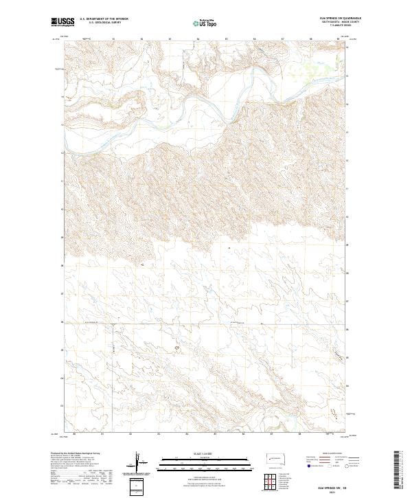
2021 Map of Elm Springs SW
USGS Topo · Published 2021About this map
The Belle Fourche River winds through this section of Meade County, creating a distinct hydrological corridor across the northern landscape. This 2021 survey by the U.S. Geological Survey shows a sparsely populated ranching and agricultural region defined by intermittent drainages and wide topographic relief. Numerous creek systems, including Elm Cr, E Elm Cr, and Hay Cr, feed into the river basin from the surrounding uplands. In the southern portion of the quadrangle, Elk Cr and Adams Draw cut through the terrain, illustrating the complex drainage patterns typical of the West River country. Transport in the area is limited to established rural routes such as W Elm Springs Rd and Curlew Rd, which follow section lines and natural contours to connect the remote land parcels of the Public Land Survey System.
Find a feature on this map
16 named features on this map. Tap any name to fly to it.
Don’t see what you’re looking for? This feature index may not catch every label — zoom into the map to look around manually.
Map Details
Editions of this 2021 Elm Springs SW Map
This is the sole edition of this map. No revisions or reprints were ever made.
Other maps of this area

1953 · Viewfield
USGS Topo · 1:24,000

1953 · Hereford SE
USGS Topo · 1:24,000

1953 · Hereford NE
USGS Topo · 1:24,000

1953 · Rapid City
USGS Topo · 1:250,000

1954 · Elm Springs SW
USGS Topo · 1:24,000

1954 · Haydraw
USGS Topo · 1:24,000

1954 · Elm Springs
USGS Topo · 1:24,000

1954 · Boneita Springs
USGS Topo · 1:24,000

1957 · Rapid City
USGS Topo · 1:250,000
1957 · Owanka NE
USGS Topo · 1:24,000