
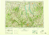
1958 Map of Elmira
USGS Topo · Published 1958About this map
The Finger Lakes Region dominates this mid-century landscape, defined by the deep glacial troughs of Seneca Lake, Cayuga Lake, and Keuka Lake. This area was a critical nexus for transportation and education in 1958, anchored by major hubs like Elmira, Ithaca, and Auburn. The map captures the significant industrial and military footprint of the era, most notably the Seneca Ordnance Depot situated between the lakes and the sprawling grounds of Cornell University.
Find a feature on this map
152 named features on this map. Tap any name to fly to it.
Don’t see what you’re looking for? This feature index may not catch every label — zoom into the map to look around manually.
Map Details
Editions of this 1958 Elmira Map
2 editions found
Other maps of this area

1893 · Ithaca
USGS Topo · 1:62,500

1895 · Chittenango
USGS Topo · 1:62,500

1895 · Rochester
USGS Topo · 1:62,500

1895 · Ithaca
USGS Topo · 1:62,500

1895 · Elmira
USGS Topo · 1:62,500

1895 · Syracuse
USGS Topo · 1:62,500

1897 · Albion
USGS Topo · 1:62,500

1897 · Cazenovia
USGS Topo · 1:62,500

1898 · Rochester
USGS Topo · 1:62,500

1898 · Syracuse
USGS Topo · 1:62,500