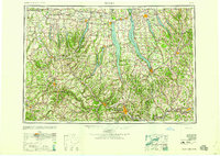
1958 Map of Elmira
USGS Topo · Published 1958About this map
Seneca Lake and Cayuga Lake dominate this mid-century portrait of the Finger Lakes region, a landscape defined by deep glacial troughs and the industrial arteries of the southern tier. The map illustrates the transition of transportation in the late 1940s and 1950s, showing the brand-new New York State Thruway cutting across the northern reaches near Waterloo and Seneca Falls, while the venerable Erie Canal follows the path of the Seneca River. To the south, the manufacturing hubs of Elmira and Corning are linked by the Chemung River and a dense network of competing railroads including the Pennsylvania and Erie lines. Rural life is anchored by smaller settlements like Penn Yan at the head of Keuka Lake and the collegiate center of Ithaca at the southern tip of Cayuga. High points such as Hector Backbone and Call Hill overlook a topography where every valley floor carries the weight of 19th-century rail infrastructure and river-borne trade.
Find a feature on this map
101 named features on this map. Tap any name to fly to it.
Don’t see what you’re looking for? This feature index may not catch every label — zoom into the map to look around manually.
Map Details
Editions of this 1958 Elmira Map
2 editions found

Other maps of this area

1893 · Ithaca
USGS Topo · 1:62,500

1895 · Chittenango
USGS Topo · 1:62,500

1895 · Rochester
USGS Topo · 1:62,500

1895 · Ithaca
USGS Topo · 1:62,500

1895 · Elmira
USGS Topo · 1:62,500

1895 · Syracuse
USGS Topo · 1:62,500

1897 · Albion
USGS Topo · 1:62,500

1897 · Cazenovia
USGS Topo · 1:62,500

1898 · Rochester
USGS Topo · 1:62,500

1898 · Syracuse
USGS Topo · 1:62,500