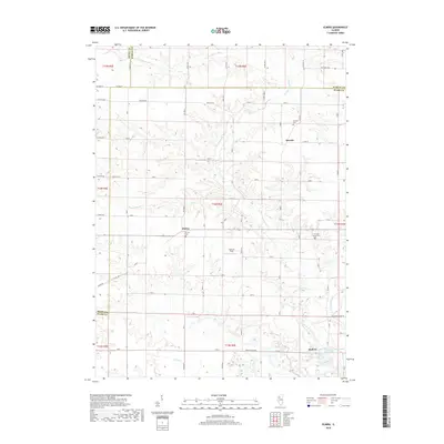
2018 Map of Elmira
USGS Topo · Published 2018About this map
Osceola and the small unincorporated community of Elmira anchor this agricultural landscape in Stark County, where the terrain is deeply defined by the branching waters of the Spoon River. The drainage network includes the W Fork Spoon River, E Fork Spoon River, and Jack Cr, which cut through the level prairie to create localized relief. Genealogists will find three distinct burial grounds on this sheet: Osceola Cem, Elmira Cem, and the Osceola Grove Cem situated to the east. Further south, near the boundary with Henry and Bureau counties, the village of Modena sits above the Jug Run drainage, while the Allendale Conservation Club Lake provides a notable local landmark. The map documents a classic Midwestern sectional grid, where roads like Saxon Rd and Osceola Rd trace the historical property lines of the Public Land Survey System.
Find a feature on this map
56 named features on this map. Tap any name to fly to it.
Don’t see what you’re looking for? This feature index may not catch every label — zoom into the map to look around manually.
Map Details
Editions of this 2018 Elmira Map
This is the sole edition of this map. No revisions or reprints were ever made.
Other maps of this area

1921 · Buda
USGS Topo · 1:62,500

1923 · Buda
USGS Topo · 1:62,500

1929 · Annawan
USGS Topo · 1:62,500

1932 · Annawan
USGS Topo · 1:62,500

1933 · Camp Grove
USGS Topo · 1:48,000

1944 · Kewanee
USGS Topo · 1:62,500

1945 · Bradford
USGS Topo · 1:62,500

1958 · Aurora
USGS Topo · 1:250,000

1961 · Aurora
USGS Topo · 1:250,000
1983 · Castleton
USGS Topo · 1:24,000