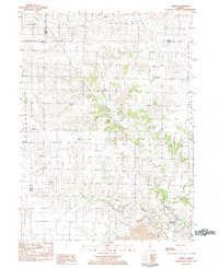
1983 Map of Elmira
USGS Topo · Published 1984About this map
Spoon River and its tributaries define the rolling agricultural landscape of this Stark County region in the early 1980s. The map illustrates a settled rural pattern where small unincorporated communities like Elmira and Osceola serve as local hubs. Genealogists will find significant value in the documentation of the Osceola Cem and Osceola Grove Cem, which anchor the history of these farming townships. While much of the land is dedicated to cultivation, the presence of a Strip Mine in the southern portion near Modena indicates the reach of the Illinois coal industry into the prairie. The drainage network, including Jack Creek and the West Fork, reveals the natural topography that dictated early property lines and road placements across the Elmira and Osceola townships.
Find a feature on this map
20 named features on this map. Tap any name to fly to it.
Don’t see what you’re looking for? This feature index may not catch every label — zoom into the map to look around manually.
Map Details
Editions of this 1983 Elmira Map
This is the sole edition of this map. No revisions or reprints were ever made.
Other maps of this area

1921 · Buda
USGS Topo · 1:62,500

1923 · Buda
USGS Topo · 1:62,500

1929 · Annawan
USGS Topo · 1:62,500

1932 · Annawan
USGS Topo · 1:62,500

1933 · Camp Grove
USGS Topo · 1:48,000

1944 · Kewanee
USGS Topo · 1:62,500

1945 · Bradford
USGS Topo · 1:62,500

1958 · Aurora
USGS Topo · 1:250,000

1961 · Aurora
USGS Topo · 1:250,000
1983 · Castleton
USGS Topo · 1:24,000