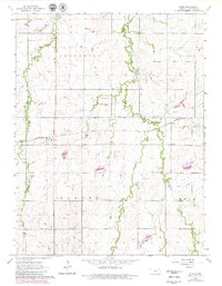
1964 Map of Elmo
USGS Topo · Published 1980About this map
The Missouri Pacific railroad corridor serves as the primary East-West artery through this central Kansas landscape, connecting the small agricultural communities of Elmo and Dillon. The surrounding terrain is defined by the headwaters of the Turkey Creek system, including the West Branch Turkey Creek and East Turkey Creek. These waterways carve through the undulating topography of Jefferson, Banner, and Hope townships, where the land is primarily utilized for farming and resource extraction.
Find a feature on this map
17 named features on this map. Tap any name to fly to it.
Don’t see what you’re looking for? This feature index may not catch every label — zoom into the map to look around manually.
Map Details
Editions of this 1964 Elmo Map
3 editions found
Other maps of this area

1889 · Abilene
USGS Topo · 1:125,000

1894 · Abilene
USGS Topo · 1:125,000

1955 · Hutchinson
USGS Topo · 1:250,000

1959 · Hutchinson
USGS Topo · 1:250,000

1963 · Abilene SW
USGS Topo · 1:24,000
1963 · Holland
USGS Topo · 1:24,000

1964 · Elmo
USGS Topo · 1:24,000

1964 · Carlton
USGS Topo · 1:24,000

1964 · Ramona
USGS Topo · 1:24,000

1964 · Navarre
USGS Topo · 1:24,000