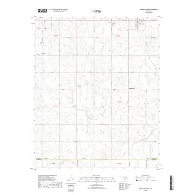
2018 Map of Elmore City South
USGS Topo · Published 2018About this map
Elmore City and the surrounding plains of Garvin County define this Oklahoma landscape during the late twenty-teens. The map reveals a transition from the southern edge of town into a rural patchwork of section-line roads and family-named landmarks like Calvin Pickens. Small agricultural and residential clusters are anchored by the settlements of Foster and Satterwhite, each connected by a grid of routes such as E1670 Rd and State Hwy 29.
Find a feature on this map
50 named features on this map. Tap any name to fly to it.
Don’t see what you’re looking for? This feature index may not catch every label — zoom into the map to look around manually.
Map Details
Editions of this 2018 Elmore City South Map
This is the sole edition of this map. No revisions or reprints were ever made.
Other maps of this area
1898 · Pauls Valley
USGS Topo · 1:125,000
1901 · Addington
USGS Topo · 1:125,000
1901 · Ardmore
USGS Topo · 1:125,000
1902 · Pauls Valley
USGS Topo · 1:125,000
1902 · Rush Springs
USGS Topo · 1:125,000
1918 · Ardmore
USGS Topo · 1:125,000
1957 · Ardmore
USGS Topo · 1:250,000
1963 · Ardmore
USGS Topo · 1:250,000
1968 · Fox NE
USGS Topo · 1:24,000
1969 · Hennepin
USGS Topo · 1:24,000