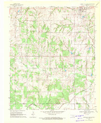
1969 Map of Elmore City South
USGS Topo · Published 1971About this map
The Elmore Field dominates the landscape south of Elmore City, revealing a mid-century petroleum economy defined by numerous Oil Wells and a local Refinery. This late 1960s snapshot of Garvin County captures the transition from open range to industrial resource extraction, centered on the community of Foster and the smaller settlement at Satterwhite. Moving south, the terrain descends toward the Wildhorse Creek valley, where the boundary between Garvin Co and Carter Co is marked by meandering drainage patterns.
Find a feature on this map
23 named features on this map. Tap any name to fly to it.
Don’t see what you’re looking for? This feature index may not catch every label — zoom into the map to look around manually.
Map Details
Editions of this 1969 Elmore City South Map
This is the sole edition of this map. No revisions or reprints were ever made.
Other maps of this area

1898 · Pauls Valley
USGS Topo · 1:125,000

1901 · Addington
USGS Topo · 1:125,000

1901 · Ardmore
USGS Topo · 1:125,000

1902 · Pauls Valley
USGS Topo · 1:125,000

1902 · Rush Springs
USGS Topo · 1:125,000

1918 · Ardmore
USGS Topo · 1:125,000

1957 · Ardmore
USGS Topo · 1:250,000

1963 · Ardmore
USGS Topo · 1:250,000

1968 · Fox NE
USGS Topo · 1:24,000

1969 · Hennepin
USGS Topo · 1:24,000