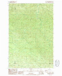
1986 Map of Elochoman Pass
USGS Topo · Published 1986About this map
Elochoman Pass serves as a critical geographic junction in the mid-1980s, marking the rugged convergence of Lewis, Pacific, and Wahkiakum counties. The landscape is defined by its complex drainage systems, where the headwaters of the Chehalis River and its multiple branches, including the West Fork Chehalis River and East Fork Chehalis River, begin their descent through the timbered highlands. This period of the survey captures a terrain primarily utilized for resource extraction, indicated by the presence of a Borrow Pit and a network of unimproved roads and trails that navigate between high points like Sage Creek Low Gap. The map provides a detailed view of the intricate stream network, including Big Roger Creek and the North Fork Elochoman River, illustrating the natural boundaries that shaped early land use and county divisions in this part of Washington.
Find a feature on this map
20 named features on this map. Tap any name to fly to it.
Don’t see what you’re looking for? This feature index may not catch every label — zoom into the map to look around manually.
Map Details
Editions of this 1986 Elochoman Pass Map
This is the sole edition of this map. No revisions or reprints were ever made.
Other maps of this area

1941 · Walville
USGS Topo · 1:62,500

1941 · Meskill
USGS Topo · 1:62,500

1941 · Skamokawa
USGS Topo · 1:62,500

1953 · Hoquiam
USGS Topo · 1:250,000

1953 · Ryderwood
USGS Topo · 1:62,500

1953 · Skamokawa
USGS Topo · 1:62,500

1953 · Pe Ell
USGS Topo · 1:62,500

1953 · Adna
USGS Topo · 1:62,500

1957 · Hoquiam
USGS Topo · 1:250,000

1958 · Hoquiam
USGS Topo · 1:250,000