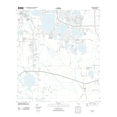
2012 Map of Eloise
USGS Topo · Published 2012About this map
Lake Eloise and Lake Winterset dominate this Central Florida landscape, forming part of a complex chain of lakes that has long defined the region's geography and recreation. The residential and commercial development of Eloise and Lake Shipp Heights is visible in the northwest, while the southeastern corner transition toward West Lake Wales and the Lake Wales Municipal Airport. Grounded in the local heritage of Polk County, the map identifies the Whidden Cemetery and the Cypress Gardens Fire Tower, landmarks that provide essential points of reference for genealogists and local historians. The drainage patterns of Peace Cr and Boggy Br weave through the southern half of the quadrangle, illustrating the low-lying terrain and wetlands surrounding smaller bodies of water like Lake Garfield and Flora Lake.
Find a feature on this map
199 named features on this map. Tap any name to fly to it.
Don’t see what you’re looking for? This feature index may not catch every label — zoom into the map to look around manually.
Map Details
Editions of this 2012 Eloise Map
This is the sole edition of this map. No revisions or reprints were ever made.
Other maps of this area

1944 · Auburndale
USGS Topo · 1:31,680

1949 · Bartow
USGS Topo · 1:24,000

1950 · Bartow
USGS Topo · 1:24,000

1952 · Homeland
USGS Topo · 1:24,000

1952 · Lake Wales
USGS Topo · 1:24,000

1952 · Babson Park
USGS Topo · 1:24,000

1953 · Dundee
USGS Topo · 1:24,000

1955 · Eloise
USGS Topo · 1:24,000

1955 · Alturas
USGS Topo · 1:24,000

1955 · Orlando
USGS Topo · 1:250,000