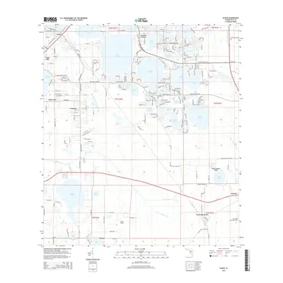
2015 Map of Eloise
USGS Topo · Published 2015About this map
Lake Eloise and Lake Winterset dominate the central landscape of this Polk County region, where the interconnected waterways of the Winter Haven area meet expanding residential and agricultural corridors. The settlement of Eloise sits at the northern edge, while the town of Eagle Lake and the community of Wahneta mark the western expansion toward the Wahneta Farms Drainage Canal. This modern survey reveals the extensive management of the Florida watershed, with the Peace Cr Drainage Canal and Peace Creek itself winding through the south, eventually passing near Alturas and Floritan. Local history and family researchers can identify specific landmarks such as Whidden Cemetery Rd and the namesake Cypress Gardens area. The transition from lakefront citrus groves to suburban development is evident in the dense street grids of West Lake Wales and the proximity of industrial sites near Boggy Br and Lake Garfield.
Find a feature on this map
164 named features on this map. Tap any name to fly to it.
Don’t see what you’re looking for? This feature index may not catch every label — zoom into the map to look around manually.
Map Details
Editions of this 2015 Eloise Map
This is the sole edition of this map. No revisions or reprints were ever made.
Other maps of this area

1944 · Auburndale
USGS Topo · 1:31,680

1949 · Bartow
USGS Topo · 1:24,000

1950 · Bartow
USGS Topo · 1:24,000

1952 · Homeland
USGS Topo · 1:24,000

1952 · Lake Wales
USGS Topo · 1:24,000

1952 · Babson Park
USGS Topo · 1:24,000

1953 · Dundee
USGS Topo · 1:24,000

1955 · Eloise
USGS Topo · 1:24,000

1955 · Alturas
USGS Topo · 1:24,000

1955 · Orlando
USGS Topo · 1:250,000