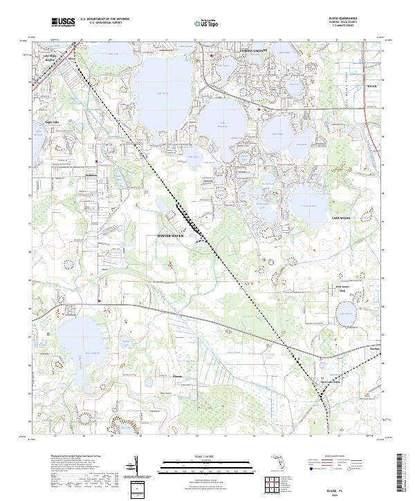
2024 Map of Eloise
USGS Topo · Published 2024About this map
Winter Haven and its surrounding lake-studded landscape are the focus of this contemporary topographic study, showing the modern suburban and agricultural character of Central Florida. The terrain is dominated by the Lake Wales Ridge, a geologically significant formation that provides the elevation for numerous named water bodies, including Lake Eloise, Lake Winterset, and the large Lake Ashton. The map documents the persistent influence of water management on the land through features like the Wahneta Farms Drainage Canal and the natural course of Peace Creek.
Find a feature on this map
77 named features on this map. Tap any name to fly to it.
Don’t see what you’re looking for? This feature index may not catch every label — zoom into the map to look around manually.
Map Details
Editions of this 2024 Eloise Map
This is the sole edition of this map. No revisions or reprints were ever made.
Other maps of this area

1944 · Auburndale
USGS Topo · 1:31,680

1949 · Bartow
USGS Topo · 1:24,000

1950 · Bartow
USGS Topo · 1:24,000

1952 · Homeland
USGS Topo · 1:24,000

1952 · Lake Wales
USGS Topo · 1:24,000

1952 · Babson Park
USGS Topo · 1:24,000

1953 · Dundee
USGS Topo · 1:24,000

1955 · Eloise
USGS Topo · 1:24,000

1955 · Alturas
USGS Topo · 1:24,000

1955 · Orlando
USGS Topo · 1:250,000