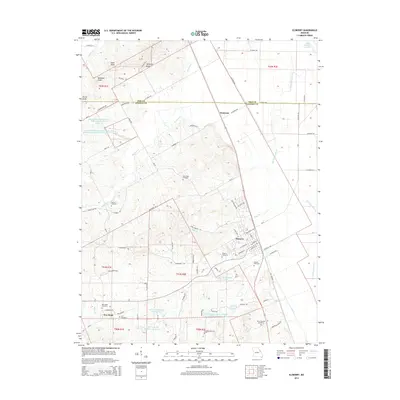
2014 Map of Elsberry
USGS Topo · Published 2014About this map
Elsberry stands as the primary hub in this eastern Missouri landscape, where the street grid of Broadway St and W Lincoln St meets the rural reaches of Lincoln County Number 2 Reservoir. The area is defined by its water management and agricultural drainage, visible in the network of the Lost Cr Watershed F-2 Lake and the Lost Cr Watershed Sediment Control Structure F-4 Dam. To the north, the terrain rises toward Saltpeter Bluff and Woodson Knob, marking the transition from the Mississippi River floodplains toward the interior uplands. Genealogists will find a high density of burial sites throughout the quadrangle, from the larger Elsberry Cemetery to family-named locations like the Cannon Cemetery, Palmer Cemetery, and Vance-Seaman Cemetery. The boundary between Pike and Lincoln counties cuts across the northern section, passing near the small settlement of Dameron and the headwaters of Bryants Cr.
Find a feature on this map
74 named features on this map. Tap any name to fly to it.
Don’t see what you’re looking for? This feature index may not catch every label — zoom into the map to look around manually.
Map Details
Editions of this 2014 Elsberry Map
This is the sole edition of this map. No revisions or reprints were ever made.
Other maps of this area

1930 · Pearl
USGS Topo · 1:62,500

1930 · Nebo
USGS Topo · 1:62,500

1930 · Hardin
USGS Topo · 1:62,500

1934 · Nebo
USGS Topo · 1:48,000

1934 · Elsberry
USGS Topo · 1:48,000

1934 · Hardin
USGS Topo · 1:62,500

1938 · Hardin
USGS Topo · 1:62,500

1942 · Nebo
USGS Topo · 1:62,500

1942 · Elsberry
USGS Topo · 1:62,500

1948 · Quincy
USGS Topo · 1:250,000