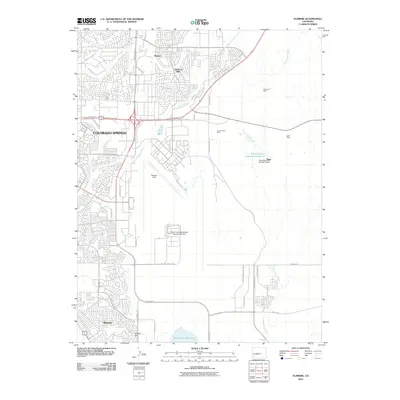
2010 Map of Elsmere
USGS Topo · Published 2010About this map
Colorado Springs is shown during a period of significant eastern expansion and infrastructure development on this 2010 survey. The landscape is defined by the intersection of residential growth in Cimarron Hills and the massive operational footprint of Peterson Field and the City of Colorado Springs Municipal Airport. To the south, the community of Security sits near the base of Skinner Hill, while the eastern portion of the map remains largely open, marked by legacy extraction sites like the McFerran Mine, Jimmy Camp Mine, and Kurie Mine. Water management is prominent through several storage systems, including the Banning Lewis Reservoir Number 8 and the expansive Big Johnson Reservoir. The drainage patterns of Sand Creek and Jimmy Camp Creek suggest the natural topography that dictated early settlement patterns before modern thoroughfares like Powers Blvd reshaped the urban corridor.
Find a feature on this map
41 named features on this map. Tap any name to fly to it.
Don’t see what you’re looking for? This feature index may not catch every label — zoom into the map to look around manually.
Map Details
Editions of this 2010 Elsmere Map
This is the sole edition of this map. No revisions or reprints were ever made.
Other maps of this area

1893 · Colorado Springs
USGS Topo · 1:125,000

1909 · Colorado Springs
USGS Topo · 1:125,000

1942 · Colorado Springs
USGS Topo · 1:125,000

1948 · Falcon
USGS Topo · 1:24,000

1948 · Colorado Springs
USGS Topo · 1:62,500

1948 · Pikeview
USGS Topo · 1:24,000

1948 · Fountain
USGS Topo · 1:24,000

1948 · Colorado Springs
USGS Topo · 1:24,000

1948 · Cheyenne Mountain
USGS Topo · 1:24,000

1948 · Falcon
USGS Topo · 1:62,500