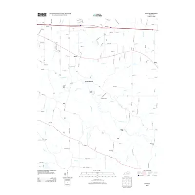
2013 Map of Elva
USGS Topo · Published 2013About this map
Clarks River meanders through this portion of Marshall County, defining a landscape shaped by narrow waterways and traditional crossings. The settlement of Elva sits central to the sheet, surrounded by several family-named burial grounds like Wallace Cem and Feezor Cem, which offer significant value for genealogical research in this rural corridor. Historically significant transit points are identified by features such as Harris Hill Ford and Bryan Ford Bridge, marking where locals negotiated the river's path long before modern infrastructure dominated. The northern boundary is defined by the heavy transit of I-24, contrasting with the quiet terrain around Hogskin Ridge and the winding Dunn Slough Cr. These features, alongside the hamlet of Sharpe, reveal a community where agriculture and family history remain deeply rooted in the physical geography of the river valley.
Find a feature on this map
53 named features on this map. Tap any name to fly to it.
Don’t see what you’re looking for? This feature index may not catch every label — zoom into the map to look around manually.
Map Details
Editions of this 2013 Elva Map
This is the sole edition of this map. No revisions or reprints were ever made.
Other maps of this area

1926 · Paducah
USGS Topo · 1:62,500

1929 · Smithland
USGS Topo · 1:62,500

1929 · Paducah
USGS Topo · 1:62,500

1936 · Paducah
USGS Topo · 1:24,000

1936 · Oak Level
USGS Topo · 1:24,000

1936 · Elva
USGS Topo · 1:24,000

1936 · Hardin
USGS Topo · 1:24,000

1936 · Smithland
USGS Topo · 1:48,000

1936 · Symsonia
USGS Topo · 1:24,000

1936 · Benton
USGS Topo · 1:48,000