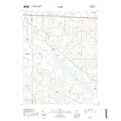
2019 Map of Elva
USGS Topo · Published 2019About this map
Clarks River dominates this landscape as it meanders toward Calvert City, creating a complex network of wetlands including Milliken Swamp, Dunn Slough, and Persimmon Slough Cr. The terrain is marked by distinctive hydrological features such as Steam Mill Bend and the sharp turn of Devils Elbow near Hogskin Ridge. Small crossroads communities like Sharpe, Elva, and Iola are scattered across the region, connected by a dense grid of rural roads named for local families and landmarks. Genealogists will find a high density of burial sites, ranging from the Sharpe Church of Christ Cem to smaller family plots like the Ewing - Dishman Cem and Feezor Cem. The presence of several river crossings, such as Harris Hill Ford and the McCoy Ford Bridge, illustrates the historical reliance on these specific points to navigate the swampy bottomlands.
Find a feature on this map
141 named features on this map. Tap any name to fly to it.
Don’t see what you’re looking for? This feature index may not catch every label — zoom into the map to look around manually.
Map Details
Editions of this 2019 Elva Map
This is the sole edition of this map. No revisions or reprints were ever made.
Other maps of this area

1926 · Paducah
USGS Topo · 1:62,500

1929 · Smithland
USGS Topo · 1:62,500

1929 · Paducah
USGS Topo · 1:62,500

1936 · Paducah
USGS Topo · 1:24,000

1936 · Oak Level
USGS Topo · 1:24,000

1936 · Elva
USGS Topo · 1:24,000

1936 · Hardin
USGS Topo · 1:24,000

1936 · Smithland
USGS Topo · 1:48,000

1936 · Symsonia
USGS Topo · 1:24,000

1936 · Benton
USGS Topo · 1:48,000