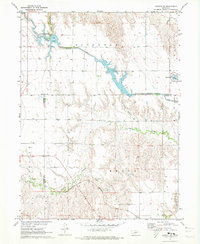
1971 Map of Elwood NW
USGS Topo · Published 1973About this map
The Tri County Supply Canal snakes across the central Nebraska plains, feeding a series of artificial reservoirs including Gallagher Lake and the northern tip of Johnson Lake. These water management features are integral to the regional landscape, supporting the Gallagher Canyon State Recreation Area and providing irrigation across the Gosper Co and Dawson Co border. South of the canal, the terrain is deeply dissected by the winding Plum Creek Canyon and Gallagher Canyon, where Plum Creek meanders through complex topographic relief.
Find a feature on this map
16 named features on this map. Tap any name to fly to it.
Don’t see what you’re looking for? This feature index may not catch every label — zoom into the map to look around manually.
Map Details
Editions of this 1971 Elwood NW Map
2 editions found
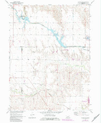
Other maps of this area

1896 · Lexington
USGS Topo · 1:125,000

1899 · Lexington
USGS Topo · 1:125,000

1902 · Gothenburg
USGS Topo · 1:125,000

1954 · McCook
USGS Topo · 1:250,000

1955 · Grand Island
USGS Topo · 1:250,000

1957 · McCook
USGS Topo · 1:250,000

1957 · Grand Island
USGS Topo · 1:250,000

1958 · McCook
USGS Topo · 1:250,000

1958 · Grand Island
USGS Topo · 1:250,000

1962 · Lexington West
USGS Topo · 1:24,000