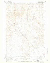
1967 Map of Emblem
USGS Topo · Published 1969About this map
Agricultural development in Big Horn County defines the landscape shown in this 1960s photogrammetric survey. The small settlement of Emblem sits at the base of the Emblem Bench, a prominent plateau that dominates the southern portion of the sheet. The reliance on water management in this arid environment is evident through the network of the Dry Creek Lateral Bench Canal and the North Bench Canal, which skirt the lower elevations to support local farming operations.
Find a feature on this map
22 named features on this map. Tap any name to fly to it.
Don’t see what you’re looking for? This feature index may not catch every label — zoom into the map to look around manually.
Map Details
Editions of this 1967 Emblem Map
2 editions found
Other maps of this area

1951 · Burlington
USGS Topo · 1:24,000

1951 · Y U Bench NE
USGS Topo · 1:24,000

1951 · Otto
USGS Topo · 1:24,000

1955 · Cody
USGS Topo · 1:250,000

1958 · Cody
USGS Topo · 1:250,000

1962 · Cody
USGS Topo · 1:250,000

1966 · Gilmore Hill NE
USGS Topo · 1:24,000

1966 · North Emblem Reservoir
USGS Topo · 1:24,000

1966 · Gilmore Hill SE
USGS Topo · 1:24,000

1966 · Jack Horner Reservoir
USGS Topo · 1:24,000