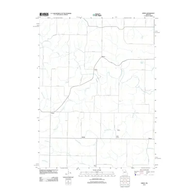
2012 Map of Emden
USGS Topo · Published 2012About this map
North River and its numerous tributaries, including Tiger Fork and Merrills Branch, dictate the settlement patterns of this Missouri landscape. The terrain is characterized by a network of rural routes such as Highway JJ and Highway DD connecting small agricultural communities. Central to this map is the settlement of Bellville, situated amidst a cluster of family-centered landmarks like Ebenezer Cemetery and Calvert Cemetery. To the west, the community of Emden lies near the headwaters of Moreland Branch, while Warren and Deer Lick anchor the eastern and southern edges of the survey. The mapping of Bevill Lake and various named branches like Hawkins Branch illustrates the intricate drainage system that has historically supported the local farming economy in Marion and Shelby counties.
Find a feature on this map
50 named features on this map. Tap any name to fly to it.
Don’t see what you’re looking for? This feature index may not catch every label — zoom into the map to look around manually.
Map Details
Editions of this 2012 Emden Map
This is the sole edition of this map. No revisions or reprints were ever made.
Other maps of this area

1903 · Palmyra
USGS Topo · 1:125,000

1948 · Quincy
USGS Topo · 1:250,000

1949 · Durham
USGS Topo · 1:24,000

1949 · Philadelphia
USGS Topo · 1:24,000

1950 · Durham
USGS Topo · 1:24,000

1950 · Philadelphia
USGS Topo · 1:24,000

1956 · Quincy
USGS Topo · 1:250,000

1959 · Monroe City
USGS Topo · 1:24,000

1959 · Lakenan
USGS Topo · 1:24,000

1959 · Hunnewell
USGS Topo · 1:24,000