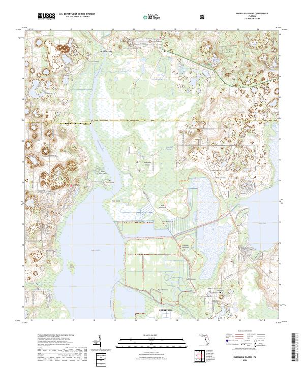
2024 Map of Emeralda Island
USGS Topo · Published 2024About this map
Emeralda Marsh and its extensive network of hammocks dominate this landscape where Lake and Marion counties meet. The complex hydrology of the Ocklawaha River basin is central to the area, connecting large water bodies like Lake Griffin and Lake Yale through a mosaic of wetlands. Within this environment, a series of named islands and hammocks—including Emeralda Island, Cabbage Hammock, and Big Hammock—provide a look at the natural topographical variations that historically dictated settlement patterns in this part of Florida.
Find a feature on this map
109 named features on this map. Tap any name to fly to it.
Don’t see what you’re looking for? This feature index may not catch every label — zoom into the map to look around manually.
Map Details
Editions of this 2024 Emeralda Island Map
This is the sole edition of this map. No revisions or reprints were ever made.
Other maps of this area

1954 · Daytona Beach
USGS Topo · 1:250,000

1955 · Orlando
USGS Topo · 1:250,000

1957 · Orlando
USGS Topo · 1:250,000

1958 · Orlando
USGS Topo · 1:250,000

1958 · Daytona Beach
USGS Topo · 1:250,000

1962 · Orlando
USGS Topo · 1:250,000

1964 · Daytona Beach
USGS Topo · 1:250,000

1965 · Leesburg East
USGS Topo · 1:24,000

1965 · Umatilla
USGS Topo · 1:24,000

1966 · Leesburg West
USGS Topo · 1:24,000