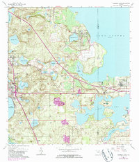
1962 Map of Clermont East
USGS Topo · Published 1987About this map
Lake Apopka and Lake Johns dominate the eastern landscape of this Florida interior, where the Seaboard Coast Line railroad creates a structural spine for citrus-era settlements. The map illustrates the transition from high, sandy ridges like Orange Mountain and Castle Hill down to the intricate marshlands and islands of the lakefronts. Numerous small water bodies such as Plum Lake and Lake Minnehaha are surrounded by groves and pockets of development including Ferndale, Minneola, and Clermont. Evidence of early community infrastructure is clear, from the High School and Woodlawn Church to the clusters of homes at Oakland and Montverde. The alignment of Florida's Turnpike cutting diagonally across the quadrangle signals the mid-century shift in transportation that would eventually reshape the region's character.
Find a feature on this map
64 named features on this map. Tap any name to fly to it.
Don’t see what you’re looking for? This feature index may not catch every label — zoom into the map to look around manually.
Map Details
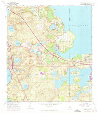
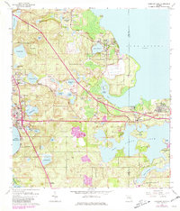
Editions of this 1962 Clermont East Map
4 editions found
Other maps of this area

1953 · Windermere
USGS Topo · 1:24,000

1955 · Orlando
USGS Topo · 1:250,000

1956 · Winter Garden
USGS Topo · 1:24,000

1957 · Orlando
USGS Topo · 1:250,000

1958 · Orlando
USGS Topo · 1:250,000

1959 · Lake Nellie
USGS Topo · 1:24,000

1959 · Lake Louisa
USGS Topo · 1:24,000

1960 · Apopka
USGS Topo · 1:24,000

1962 · Orlando
USGS Topo · 1:250,000

1962 · Clermont East
USGS Topo · 1:24,000