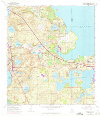
1962 Map of Clermont East
USGS Topo · Published 1972About this map
The western shores of Lake Apopka and the expansive Johns Lake define this central Florida landscape, where citrus groves and early suburban growth began to reshape the terrain during the early 1960s and 1970s. The Seaboard Coast Line railroad threads through established lakeside communities like Montverde, Minneola, and Clermont, highlighting the region's historic dependence on rail for moving citrus from local groves. Educational and social hubs such as the Lincoln Park Sch and the community of Oakland near the Lake Co Orange Co boundary mark the transition between rural lakefront and developing townships. Topographic details reveal specialized land use including a Sand and Clay Pit near Wilma Lake, while the modern corridor of Floridas Turnpike Toll Road signals the arrival of high-speed transit through formerly isolated reaches like Gourd Neck.
Find a feature on this map
65 named features on this map. Tap any name to fly to it.
Don’t see what you’re looking for? This feature index may not catch every label — zoom into the map to look around manually.
Map Details
Editions of this 1962 Clermont East Map
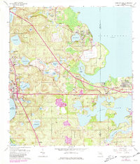
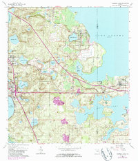
4 editions found
Other maps of this area

1953 · Windermere
USGS Topo · 1:24,000

1955 · Orlando
USGS Topo · 1:250,000

1956 · Winter Garden
USGS Topo · 1:24,000

1957 · Orlando
USGS Topo · 1:250,000

1958 · Orlando
USGS Topo · 1:250,000

1959 · Lake Nellie
USGS Topo · 1:24,000

1959 · Lake Louisa
USGS Topo · 1:24,000

1960 · Apopka
USGS Topo · 1:24,000

1962 · Orlando
USGS Topo · 1:250,000

1962 · Clermont East
USGS Topo · 1:24,000