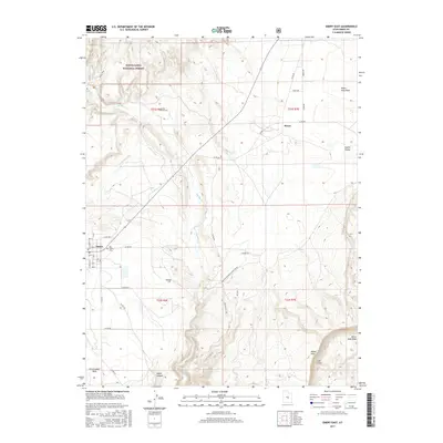
2017 Map of Emery East
USGS Topo · Published 2017About this map
Emery and the neighboring settlement of Moore occupy the irrigation-dependent landscape of Castle Valley on the eastern edge of the Manti-Lasal National Forest. This 2017 survey illustrates the intricate water management system essential to this arid region, featuring the Rochester Canal and Emery Canal that draw from Muddy Creek. The terrain transitions from the forest boundary in the northwest to the dramatic geological formations of the Molen Reef and Coal Cliffs in the southeast. Genealogists will find significant value in the documentation of local burial sites, including the Old Emery Cemetery, Muddy Creek Cemetery, and Ridge Cemetery. The presence of these sites, alongside the network of county roads like Co Rd 904 and Co Rd 801, provides a clear view of the rural infrastructure connecting the canyon lands and ranching areas such as the Rochester/Cedar Ridge Ranch.
Find a feature on this map
41 named features on this map. Tap any name to fly to it.
Don’t see what you’re looking for? This feature index may not catch every label — zoom into the map to look around manually.
Map Details
Editions of this 2017 Emery East Map
This is the sole edition of this map. No revisions or reprints were ever made.
Other maps of this area

1885 · Manti
USGS Topo · 1:250,000

1885 · Fish Lake
USGS Topo · 1:250,000

1895 · Manti
USGS Topo · 1:250,000

1896 · Fish Lake
USGS Topo · 1:250,000

1922 · Wasatch
USGS Topo · 1:31,680

1923 · Castle Dale
USGS Topo · 1:62,500

1925 · Castle Dale
USGS Topo · 1:62,500

1925 · Acord Lakes
USGS Topo · 1:62,500

1953 · Emery 1 NE
USGS Topo · 1:24,000

1953 · Emery 1 SE
USGS Topo · 1:24,000