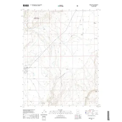
2020 Map of Emery East
USGS Topo · Published 2020About this map
The settlement of Emery sits at the edge of a high desert landscape where the Rochester Canal and Emery Canal provide the essential irrigation infrastructure for the local agricultural economy. This 2020 survey documents the intersection of human habitation and the stark geological features of the San Rafael Swell region. To the north and west, the terrain rises into the Manti-La Sal National Forest, while the southern reaches are defined by the dramatic escarpments of the Coal Cliffs and Molen Reef. The map reveals a community deeply rooted in its geography, with local history preserved at the Old Emery Cem and Ridge Cem. Along the banks of Muddy Cr, the rural character of Moore is visible, connected by a network of ranch roads that navigate the complex drainage systems of Bitter Seep Wash and Molen Seep Wash.
Find a feature on this map
44 named features on this map. Tap any name to fly to it.
Don’t see what you’re looking for? This feature index may not catch every label — zoom into the map to look around manually.
Map Details
Editions of this 2020 Emery East Map
This is the sole edition of this map. No revisions or reprints were ever made.
Other maps of this area

1885 · Manti
USGS Topo · 1:250,000

1885 · Fish Lake
USGS Topo · 1:250,000

1895 · Manti
USGS Topo · 1:250,000

1896 · Fish Lake
USGS Topo · 1:250,000

1922 · Wasatch
USGS Topo · 1:31,680

1923 · Castle Dale
USGS Topo · 1:62,500

1925 · Castle Dale
USGS Topo · 1:62,500

1925 · Acord Lakes
USGS Topo · 1:62,500

1953 · Emery 1 NE
USGS Topo · 1:24,000

1953 · Emery 1 SE
USGS Topo · 1:24,000